Logua Studio

Site photos that know where they were taken.

FootPoint is a field tool for locating, photographing and organizing engineering records. It captures position, direction and time as you shoot, lets you fill in zone, trade and stage with two taps on site, and turns the result into a PDF report or data files you can hand over.

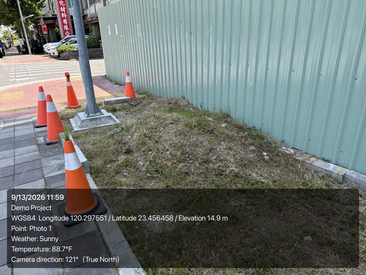
A site photo stamped with capture time, project, WGS84 / TWD97 / TWD67 coordinates and shooting direction
An exported photo: capture time, coordinates and direction stamped right on it.

Organized by project and point

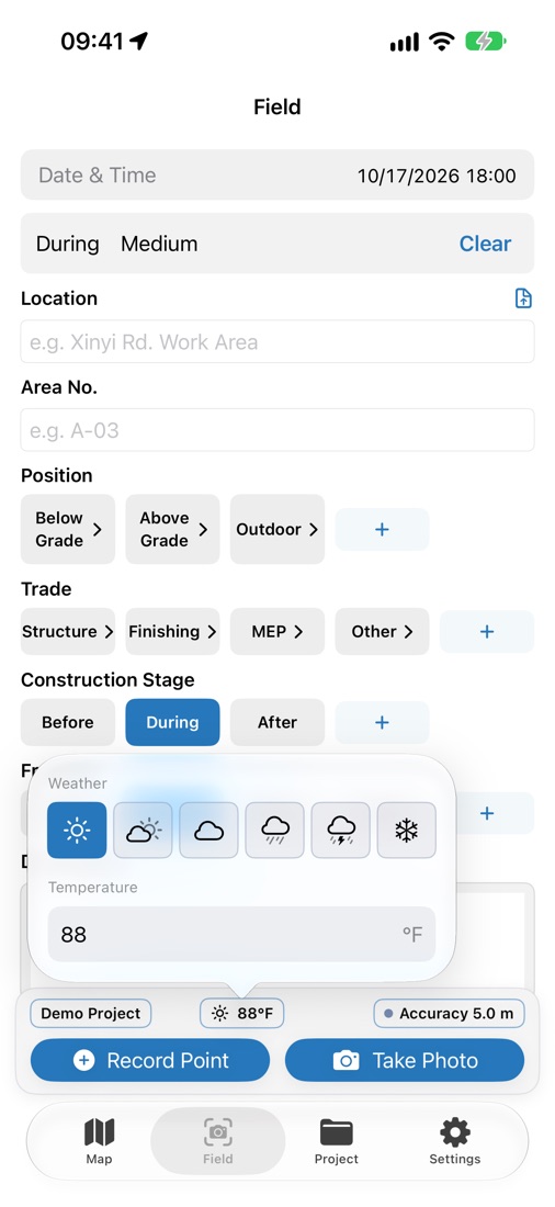
Work data stays out of your personal photo library. Each project carries its own quick-pick fields — location, zone number, position, trade, construction stage, shot type — so you tap instead of retyping the same thing on every photo.

Where it was taken, and which way

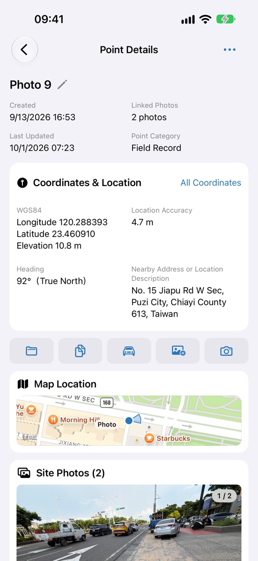
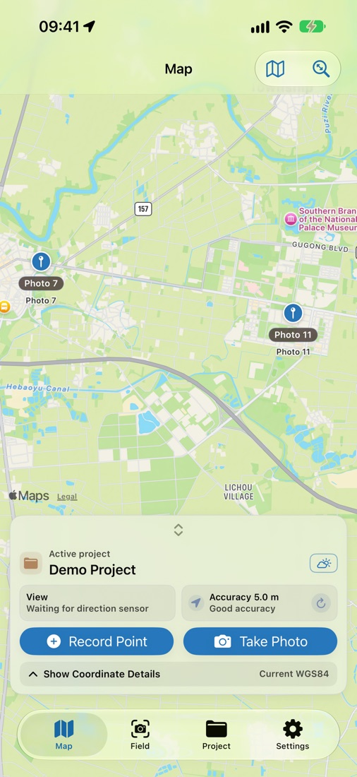
When you capture a photo in the app, its position and camera direction can be recorded with the shot, so someone who wasn't there can still tell which way the camera was facing. Points, photos and shooting directions can all be reviewed on the map, and every position carries its own accuracy.

National grids, in Taiwan and beyond

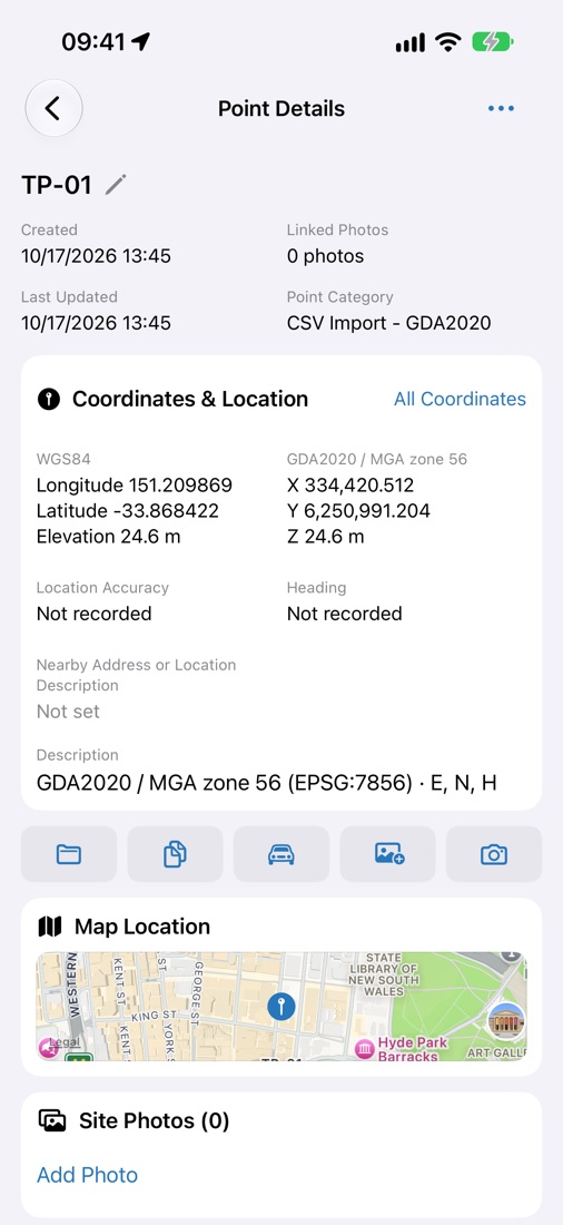
Taiwan's TWD97 and TWD67, plus Japan's Plane Rectangular CS (JGD2011), Australia's MGA2020, New Zealand's NZTM2000 and the British National Grid. FootPoint recommends a coordinate system from your current location and lets you choose one yourself; WGS84 latitude and longitude work everywhere.

Deliverables

Four PDF report templates — Complete, Concise, Measurement and Site Inspection — with a customizable layout and your company logo. Data exports as CSV, GeoJSON, KML, KMZ and TXT for an existing CAD or GIS workflow, plus photo packages and full archives. You can also import points from CSV, choosing the source coordinate system and column order.

Stays on your device

No separate account. Your points and photos stay on your device; to use them on more than one device, turn on iCloud sync and they're kept in your own iCloud account. Syncing, exporting and sharing are all your call.

English, Japanese and Traditional Chinese

The interface follows your iPhone's language setting, and PDF reports are produced in the app's current language.
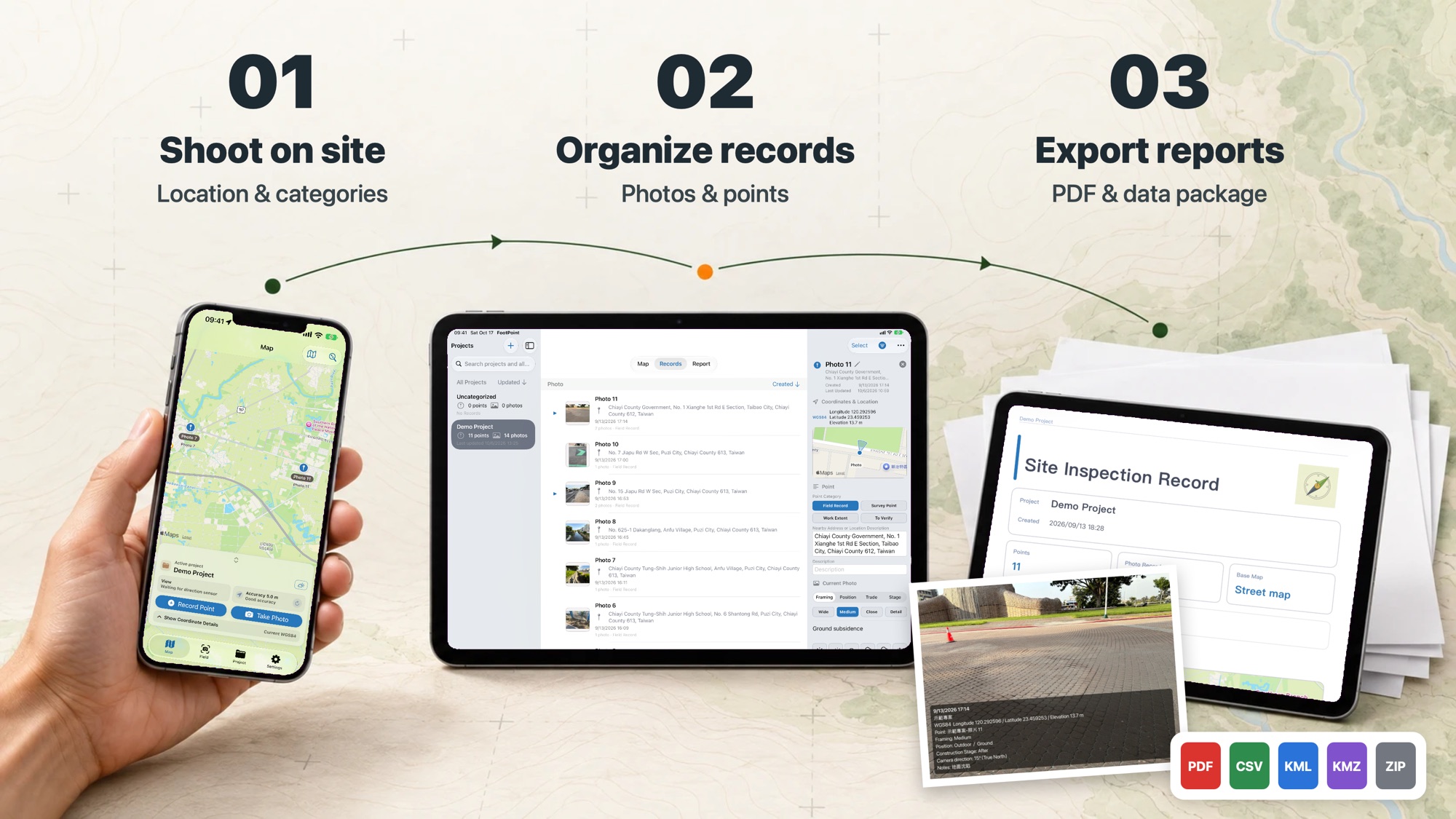
Three steps: shoot on site (location and categories), organize records (photos and points), export reports (PDF and data package)

Inside the app

From the shot on site to the report you hand over.

Field: zone, trade, stage and weather in a tap
Point details: photos, coordinates and direction
Map: where the points and photos are
Overseas grids: local coordinates beside WGS84
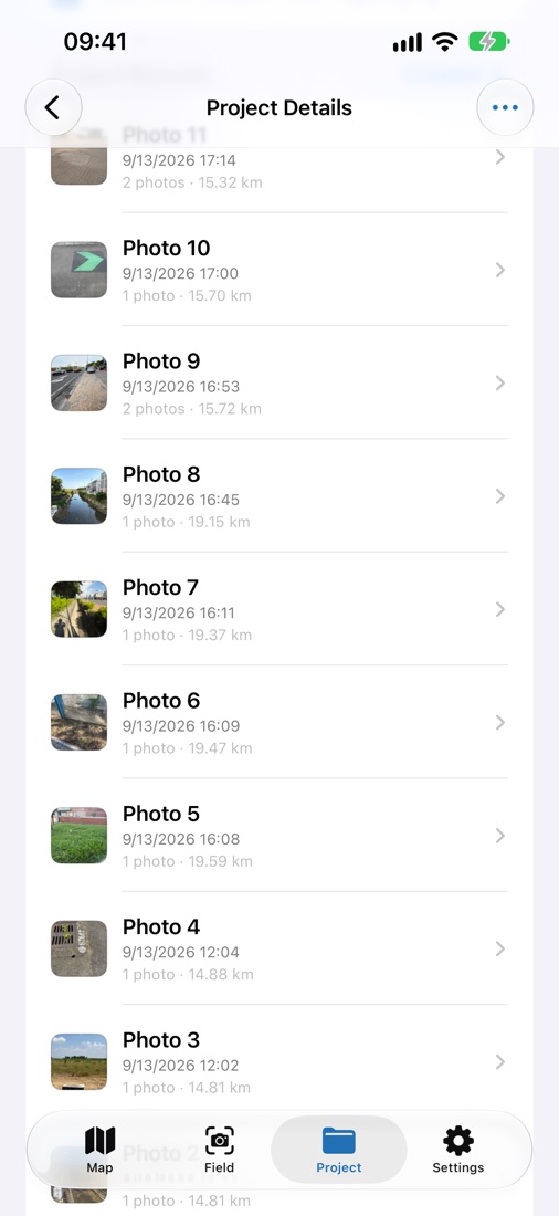
Point list: distance and photo count
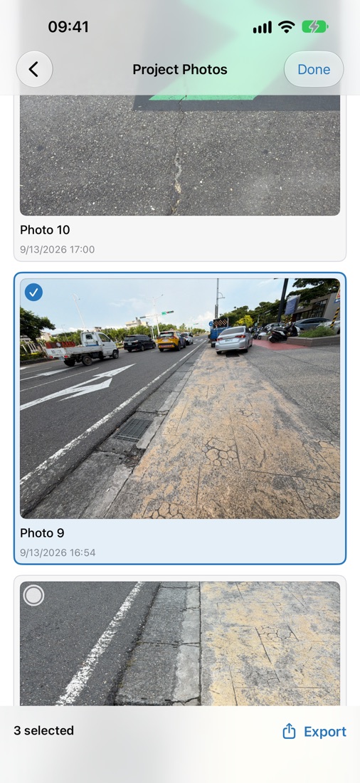
Batch export: pick several photos at once

Trial and Pro

Seven days of full access after installing.

When the trial ends, existing data remains available to open, view, edit and export. Creating new projects, points and photos requires Pro.

Core Pro features

  • PDF reports and KMZ / ZIP delivery packages
  • Your company logo and customizable PDF layouts
  • Site info watermarks (concise and detailed)
  • Create projects, points, and photos without trial limits

These are the current core Pro features.

One-time purchase. Permanent access to core Pro features. This purchase is not a subscription.